| Weather: Intermittent showers hurried on by a fresh westerly |
| Distance covered today: 17.8km (11.1mi) |
| Last night's B&B: Tan Hill Inn (£40) |
| Cumulative distance: 1046.4km (650.2mi)/ % Complete: 54.7% |
| GPS satellite track of today's route: Day 53 (click!) |
Much as I predicted, I am now so far from civilisation that not even my vaunted box of tricks can raise the internet. I have one card left to play. I do know that my hostess tonight has dial-up internet for her email, so if I can persuade her to let me on it for a minute, I might be able to post the blog and keep my 100% record! I’m certain though that even if I succeed this time, I will soon fail. I get more and more remote with each passing day.
That said, frustratingly, the Pennine Way is about to go on a number of fairly pointless loops, which means that instead of heading northwards, I’ll be zigging and zagging all over the place! Well OK, they aren’t pointless loops. Presumably they will take me to wonderful places with excellent views, which is all part of the experience.
Talking about experiences, I had a new one today! I have now left Yorkshire for County Durham, and as with Offa’s Dyke, it seems that it is the local county’s responsibility to mark the national trails. The way-marking in Yorkshire was adequate, but for some reason County Durham doesn’t seem much concerned about such trivia. Many way-markers were just absent, and I found myself having to read the map very closely to make sure I was where I was supposed to be. For much of the time, I was moving over open moorland, frequently with no discernable path. The great granite slabs marking the path of earlier legs have now disappeared, foot bridges have been replaced by stepping stones (if one is lucky!), and fairly frequently there is no way of judging precisely where the path is supposed to be, because there are no distinguishing features in the open moorland. The guidebook suggests the use of a compass is “essential”, though in good visibility, that is a little over the top.
I did find though that the moorland, despite the dry summer, can be alarmingly treacherous! At one point, I was yomping down the side of a moorland hill, talking to Veronica on the phone, therefore with both of my walking poles dangling uselessly in my other hand. I stepped onto what I thought was a solid island in the middle of a very boggy bit of turf, only to sink to my knee in gooey moorland mud! I let out a bloodcurdling yell of rage, which of course alarmed Veronica on the other end of the phone. My leg was stuck in the mud, so I just avoided turning turtle with my onrushing momentum. If I hadn’t been so cross about having a bootful of muddy water, I would have found the situation quite comic! Fortunately, I was wasn’t far from tonight’s B&B, so I just marched on and forgot about it. I have though just finished cleaning up the mess and it took me a good hour. Fortunately, there is a heated towel rail in my bathroom so things should be dry by morning!
The other experience of the day was that during the walk I transferred from the South to the North guidebook for the Pennine Way. I haven’t yet reached the half-way point in terms of distance; the entire walk is 431km (268mi) and the South covers 204km (127mi), but the change of guidebooks is something of a transition. As I swapped books, I noticed on the cover the comment that the Way “remain(s) one of the most demanding challenges to the long-distance walker”, which again made my blood run cold. I do not even consider myself a long-distance walker, despite the track record of the past few weeks, and to take on the Pennine Way now seems utter madness. I keep thinking it is going to get a whole lot worse as I head northwards. I read things about the majestic sweep of High Cup, and Cross Fell, the highest point on the Pennines, and I wonder whether I am up to it.
I keep saying to myself that it isn’t as remote as it seems. Although the vistas are immense and phenomenally beautiful, I remind myself that there is often a mobile signal near the top of the hills and the entire landscape is still, in a sense, man-made. Once upon a time, it was all covered in trees, which were cut down for firewood and to clear the land for grazing stock, just as in the moorland of Cornwall and Devon.
I have been in remoter places. Once when we lived in Namibia, I went into the wilderness of the Namib-Naukluft desert with a good friend and colleague on a camping trip. A new road had been driven through a particularly mountainous part of the desert. It wasn’t much of a road, but our 4X4 pickup more or less coped. My friend commented that there was absolutely no water in the vicinity, which was one reason that there had previously been no access. Eventually we ran out of road, and set off on foot to climb the rock-strewn mountainous outcrops, until eventually finding a suitable spot to camp. I remember looking up at the most staggering display of stars on that darkest and clearest of nights. My friend said something about there not being anyone else around, which was stating the obvious. But I had misheard him. What he had actually said was that it was just possible that we were the first human beings ever to be in that place! In his view, with no road and no water and no reason to go there, it was possible nobody ever had. Certainly, next morning, we could see absolutely nothing that was evidence of any previous human presence. He may have been wrong, but it was still an amazing thought. There are not too many places on earth where there is even the remotest possibility of such a thing being true.
At least I can console myself that no matter how daunting, the Pennine Way is not that remote. On an optimistic note, even my injured toes are picking up. The right-hand little toe is definitely on the mend, and though the left-hand little toe is still a basket-case, I’m confident a few more days are all I need.
I should be in excellent shape by about the time I complete the Pennine Way!

My eternal spring continues, this time with bluebells

The marvellous colours of Sleightholme Moor
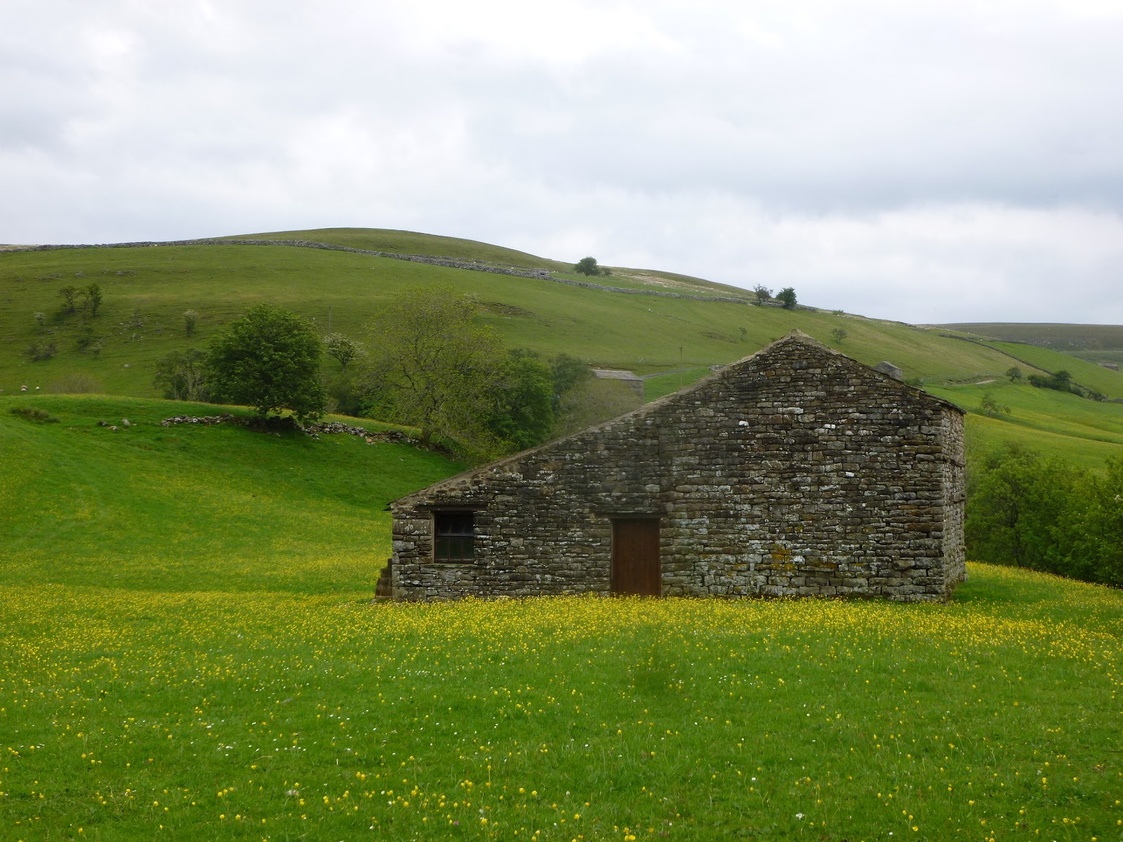
Back in exquisite meadowlands with a picturesque barn

This is God's Bridge, a natural limestone slab over the Greta River that does actually serve as a bridge!

Back to the wonderful colours of Cotherstone Moor

A lapwing in flight. They have been yelling at me for days to get out of their territory

The colours of the moors; such perfect harmony

Another barn in another meadow
3 comments:
once in Namibia my family and I walked to a beach that was pristine. We spent the afternoon lugging rocks to make a big heart in the sand. We hadn't a camera with us so the next morning we made the long pilgrimage again to take a picture. All the rocks that been "put back" where they belonged, our heart was gone and it was as though nobody had ever been there....
It seems that blog followers are divided between creationists and evolutionists. Of course this debate has been running ever since Charles Darwin published "the Origin of Species", which states, inter alia, that humans had evolved by a process of natural selection, and are not produced by divine creation. And it seems unlikely that the question will be resolved during the course of Kevin's long walk. Nevertheless it is known that people exposed to extreme conditions in new and unknown environments do experience flashes of revelation, epiphanies if you like, and other insights. Pilgrim's Progress for example.. Now we do have our friend, soon to be tramping across the Scottish highlands, possibly fortified by some of the local brew, with icy rain trickling down his neck. Surely this is the very stuff of such flashes of inspiration, visions, and other certainties brought on by the conditions. We trust that he will keep us posted.
I think that Barbara went back to the wrong spot ... of course it may have been the work of the Namibian hobbit, a small nocturnal creature that is noted for this kind of activity..
Post a Comment